
Savile Street
Gateway to the East end

There was a time in Sheffield’s history when this was one of the most important (and certainly one of the most income creating) roads in the old town. Nowadays it may be that not many of us have reason to go there, but that wasn’t the case in the past by a long way. When standing under Wicker Arches facing away from the city centre Spital Hill heads up to the left, while Savile Street lies straight ahead linking the old town centre with the industrial heartland of the East end. Savile Street was home to several important names in Sheffield industry, based there one after another; thousands and thousands of workers commuted there every day - many lived nearby, but many didn’t too, and as a result some of Sheffield’s earliest public transport links served the road.
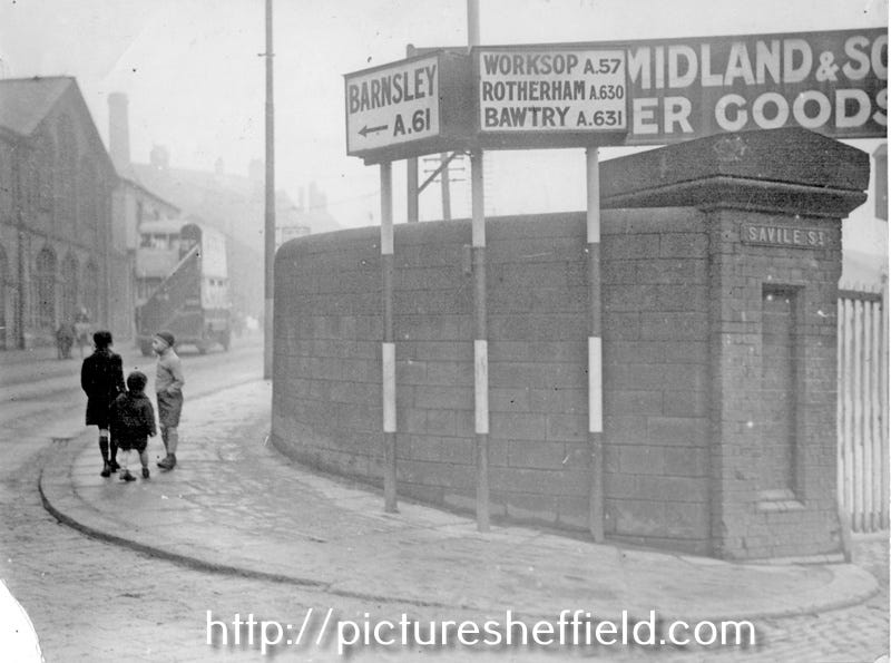
The start of Savile Street at the entrance to Wicker Goods Yard between the wars
The photo above shows the entrance to the rail goods yard that was in place until the 1960s. It stood on the site of Sheffield’s first railway station; called Wicker Station, but not actually on the Wicker and with the name of a different street under the yard’s name board - history probably should record Sheffield’s first station as being named Savile Street. If this had happened the name would have been slightly different, as until the twentieth century Savile Street had a double ‘l’. The road first appears on maps in the 1820s, so pre-dating the station, and is named after the family name of the wife of a member of the Duke of Norfolk’s family. I don’t know whether the previous different spelling was deliberate, maybe to avoid clashing with another street - but the present version appears to be the historically correct one.
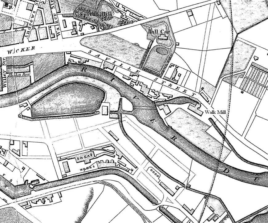
The original ‘Saville’ Street in the 1830s, before Wicker Station
The road on the map above is shorter than now, and formed the start of the old town extending out towards Attercliffe. There are several sets of buildings already between the road and the Don - the first reason for the industry being present is the close proximity of the river, and from 1819 the canal too. Sheffield was first connected by rail in 1838 and this was to become an even more prime spot for some of the city’s best known steelmakers. From around 1850, opposite the junction with Spital Hill, stood the Wicker Brewery and the Inn of the same name. The pub was known as the ‘Hole in the Wall’ by patrons, and later officially had that name, apparently due to a large hatch linking two bars inside. The old map appears to show what became Attercliffe Road continuing from our road, and later a short road linking the two was called 12 O’Clock Street, a great name still remembered by a building on the site. The name is from a former toll bar in the area - a nice curious historical street name.
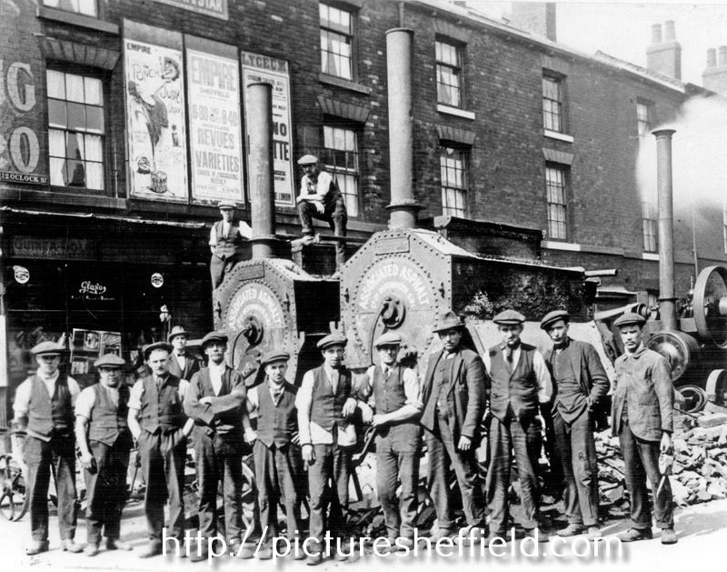
City Engineers Department workers on 12 O’Clock Street in 1926
That stretch of industry that was opposite the new station site contained a few different sectors; a saw mill, a forge, and a coopers, amongst them. Changes to the area were soon to come thick and fast. Wicker Station was joined in 1851 by Sheffield Victoria Station on the other side of the road, with the Wicker Arches having been built between the two. When the horse tramway was opened in Sheffield in 1873 the first line was from Lady’s Bridge to Attercliffe, with Savile Street part of the route. Wicker Station had closed to passengers by then, and been turned into the goods yard that it remained until the 1960s. Throughout the life of the original Sheffield tram network the words ‘via Savile Street’ often appeared on the destination boards of services to the East end.
The 1855 Ordnance Survey map that I often refer to on this page was first revised in 1863, and the differences between the two editions are many and stark; and this is one such example. An extension to the original road was called Savile Street East (the same naming method was also applied to Carlisle Street nearby) and it was here that many of the well known works were built. Between Savile Street and Carlisle Street was Charles Cammell’s Cyclops Works, a huge site complete with railway sidings provided by the main line that bisected the works. When Victoria visited the new city in 1897 to open the Town Hall the royal party went from the ceremony to Norfolk Park, and then on to Cyclops Works where the monarch watched the rolling of the armour plate that the company specialised in.
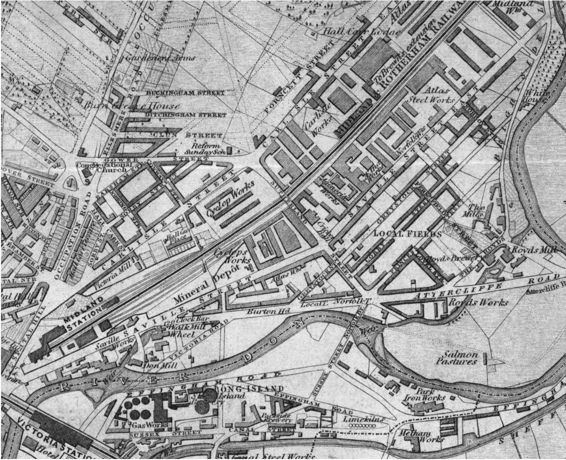
The industrial old town spreading east on the 1863 map
In addition to Cammell’s the map shows several well known Sheffield names such as Brown’s, Norfolk Works, Atlas Steel Works, Royds Works, and more. These were huge sites, dominating the street scene in a way that it is difficult to imagine today - with large imposing entrances and high walls all the way round. This was a century before the Clean Air Acts too, and it wasn’t always a pleasant area to be living or working in. Cyclops Works was first opened here in 1845 when there was still greenery around the river banks, and the railway could be seen from afar running through the Don Valley - both of which soon became swallowed up by the succession of mammoth industrial buildings that were to follow through the nineteenth century.
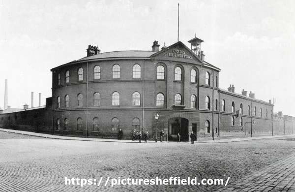
Cyclops Steel Works at the end of the nineteenth century
Later Savile Street became home to the Albion Works Head Office of another very well known Sheffield company name; Thomas W Ward Ltd. Starting as a merchant in coal and iron Ward and his firm became nationally successful in dismantling premises and ships. They dismantled the Kelham Rolling Mills at home, amongst many others across the country. Many famous ships ended their time at Ward’s too, with HMS Dreadnought amongst that number. Maybe it was natural, or appropriate, that a city that made and built so much birthed a famous company doing the opposite. Later some of the trams from the original Sheffield network were dismantled by Ward’s. Despite their local and national prominence it may be that the one thing some know about the company is their most famous ‘employee’, Lizzie the elephant - a regular sight on the streets during World War One.
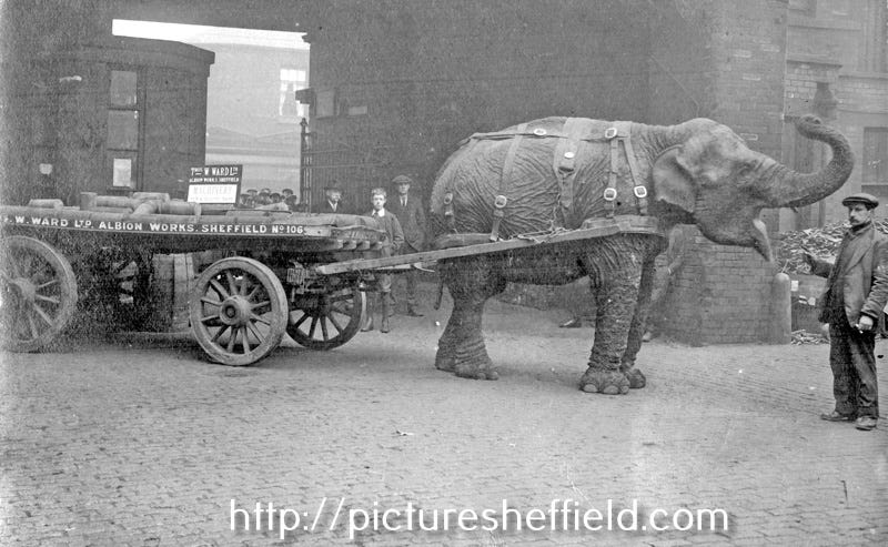
Lizzie the elephant, one time resident of Savile Street
Queen Victoria wasn’t the only royal visitor to Savile Street’s illustrious industrial premises - many important visitors to Sheffield over the years have included a look at the famous steel production on their itinerary. In July 1905 King Edward and Queen Alexandra came to the city to open the University of Sheffield, and their trip also included a visit to Savile Street. There was a fashion at royal visits to see the erecting of large decorative arches along the route of the processions - there were many made for Victoria in 1897, and again for Edward and Alexandra. The armoury industry in the area led to Brown’s ordering the arch in the photo below to be made and placed at the far end of Savile Street East. On the left is one of many pubs along the road; the old Norfolk Arms - a building that still stands at the junction with Princess Street.
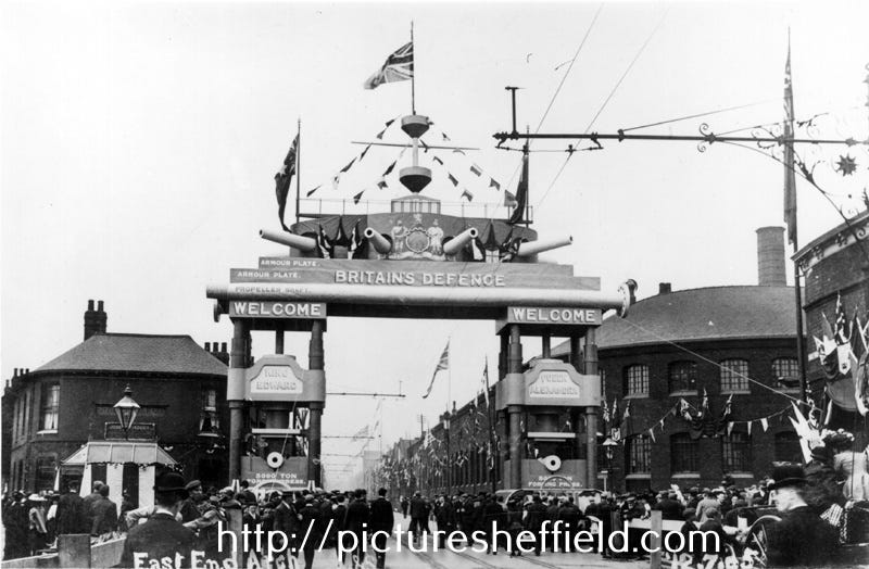
Looking back down Savile Street East in 1905 - with grand arch for the royal visitors
It is undoubtedly true that Savile Street and surrounds have changed dramatically since the city’s industrial zenith, however when I walk around the area these days I am often struck by some of the industrial areas that have survived in the East end. There are still many streets full of noisy manufacturing premises, and cafes full of workers in hard hats and steel toecaps. We still make things in Sheffield - what has changed the most is the scale. What took hundreds or thousands of workers in the past is now done by far fewer people in the resulting much smaller properties. The processes are also cleaner and quieter today - we no longer hear the clanking of heavy industry for miles around. Many things change, but some are preserved more than might be obvious at first sight; ‘Made in Sheffield’ is still a sought after and much respected description.
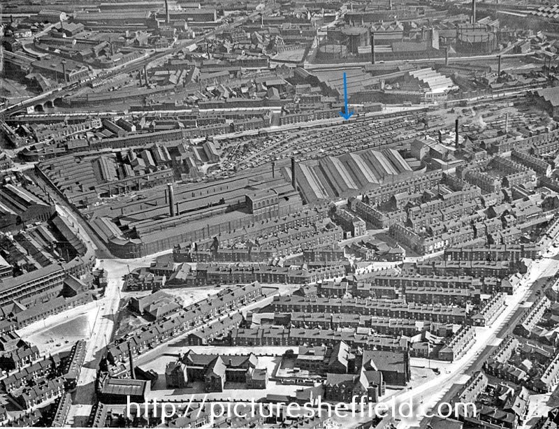
Savile Street (arrowed) and surrounds in 1932, with the huge Cyclops Works in centre