


From the archive: Ecclesall Road that was
A much changed junction.

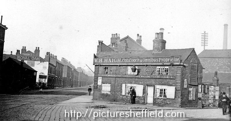
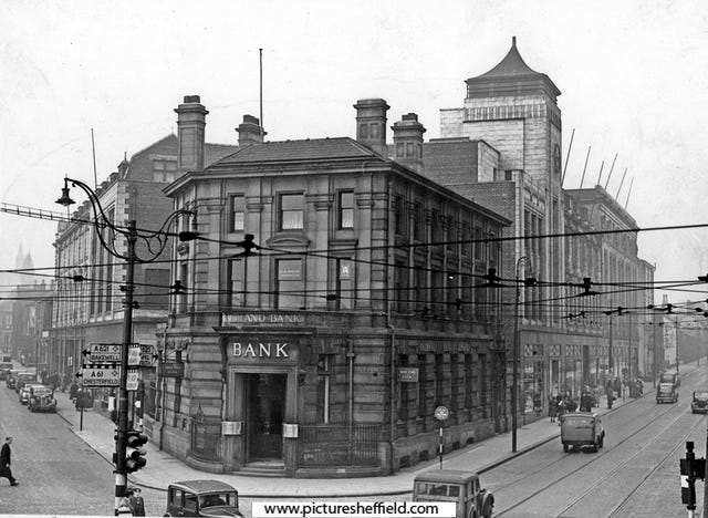
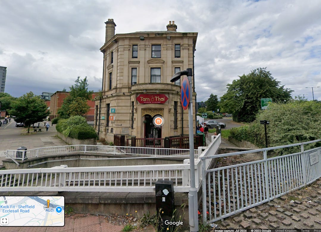
Two for one from the archive today, with plenty of differences between the photos above, which are from 1896 and 1952 - let alone the present day view which is pretty much unrecognisable. In both we are looking up Cemetery Road (left), and to the right where we would now be entering Waitrose car park, runs the old course of Ecclesall Road. This was a busy junction (and later a roundabout) joining up with Moorfoot, complete with trams coming from all directions as well as motor traffic - until the ring road broke it up. Prior to then Ecclesall Road, instead of going straight on to Moore Street, used to bear right after passing the old Sheaf Brewery (Wetherspoons) and headed to town diagonally across the current Waitrose site. In the first picture Haigh’s coaching business takes people on trips out of town, and the former Royal Oak pub stands on Cemetery Road. In the second picture, on the left hand side of Ecclesall Road, is the grand former Co-op store - whilst the somewhat changed former Midland Bank building stands alone - now a Thai restaurant. Many Sheffield folk still pass through the site every day, either on foot or wheels, making the same journey into town that people have made for centuries.
This got me thinking…I return to Sheffield and Ecclesall Road a couple of times a year, and used to walk near Wards Brewery en route to uni 40+ years ago…I presume Sheaf brewery is the same location? I didn’t know that Cemetery Rd and Ecclesall Rd intersected at one point…made me get the street map out 😊Thank you.
Fascinating stuff! 👍