
Arbourthorne
A surprisingly old area of Sheffield?

It may be surprising how far back the history of Arbourthorne goes - I didn’t have it down as being as old as I now know it is. The inter-war development of much of the present day estate is only the latest chapter in a varied story. It is sometimes the case that the names of modern parts of the city aren’t very historically accurate, or that the historic area and the modern area aren’t necessarily the same; however Arbourthorne is more an example of consistency. The area is named as ‘Arbor Thorne’ on Harrison’s Survey of the Manor of Sheffield in 1637; itself a vital historical record of what existed across our area at the time. Moving forward to the 1855 Ordnance Survey and the area has a farm, a quarry, a plantation, and a hill, named after it. Arbourthorne clearly existed distinctly and separately from neighbouring Manor and Norfolk Park.
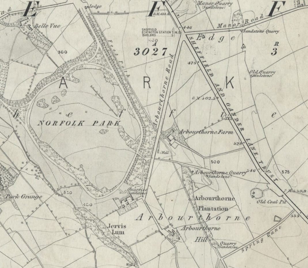
Rural Arbourthorne alongside Norfolk Park and Manor on the 1855 OS map
On the 1855 map above it can be seen that Arbourthorne Road was the original name of today’s St Aidan’s Road, while the ‘Sheffield and Gander Lane Trust’ road is now City Road, and Manor Road is Manor Lane. Whilst I like a street name change, I also like a long lasting one too; Spring Lane (now also a Supertram stop) is present in the bottom right corner. The first six-inch Ordnance Survey map of Sheffield was always going to be important to people interested in the city and its history, whenever it was made - but it often seems to find Sheffield at a transition; not long after changes, and not long before more of them too. It’s a great snapshot of the old town on the verge of its greatest era; Victorian industrial powerhouse and a future city on the world stage.
By the turn of the last century the people who lived in Arbourthorne, other than the farmers and their families, lived in one of the spaced out nice houses enjoying the country air just outside the old town. East Bank Road was named after a nearby house of the same name built in the 1830s, and further up the road stood Midhill House; a nice descriptive name. That house was later used for a working men’s club, and after that the Earl Marshal pub, standing in plenty of green space. Interestingly the road used to end there, only later extending up to Hurlfield Road (almost to Manor Top). The map below was published in the early 1890s and shows Black Bank at the top of East Bank Road. The map also shows the spring alongside Spring Lane - so not only an old street name, but a meaningful one too.
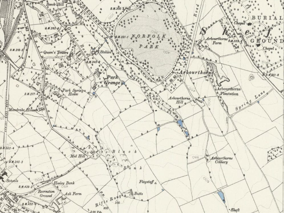
Arbourthorne in the early 1890s - still a rural outpost
Even before the area was named in the 1637 Harrison survey it had formed part of the historic Deer Park which extended across Manor and Arbourthorne and well beyond. Black Bank had dry stone walls remaining to be photographed in the early twentieth century which were thought to have originated from the park boundary - now sadly lost along with almost all traces of the Deer Park. The lost area was close to the green space which still exists alongside East Bank Road, and here was a very rural scene indeed. Near Midhill House there wasn’t the quarrying and mining found further up the hill, but a scene hard to associate with a central part of Sheffield today; the photo below shows haymaking in Arbourthorne in 1892!
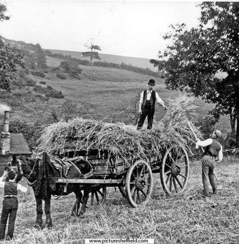
Haymaking near Midhill House on East Bank Road in 1892
Arbourthorne Quarry was located where the Guildford estate is now into the early twentieth century, and until the early 1920s the small Arbourthorne Colliery operated where Arbourthorne Recreation Ground is now, I think close to Arbourthorne Pond. These two industrial uses are not unusual in Sheffield of course, and another common sight on old maps of the city are farms; and Arbourthorne Farm stood near Norfolk Park, just off St Aidan’s Road. Interestingly the farm buildings survived into the 1960s, some time after the area was built-up. This area is not far outside the city centre of course, but the presence of pits, quarries, and a farm, show just how rural the area above Norfolk Park also was until a century ago - and how quickly it then changed.
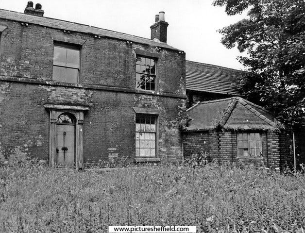
Derelict buildings of the former Arbourthorne Farm in 1965
On the old maps we’ve looked at Arbourthorne is positioned right next to Norfolk Park - but the park had only been there since the 1840s, and before it was laid out (and named for the family that donated the land) the area didn’t have that name either of course. It is likely that a larger area would now be called Arbourthorne if Norfolk Park had been placed elsewhere, and if the Duke of Norfolk hadn’t named the park after himself and his family the park could even carry the historic name of the area instead. It is interesting to note that the beautiful row of worker’s homes along the Guildford Avenue side of the park, which date from the park’s construction, are named Arbourthorne Cottages.
The Arbourthorne people know today is the estate built in the 1930s, completing the transformation from open countryside to built-up area of the city. There are a couple of interesting things from that development - in 1936 there were referendums carried out on nine new estates to decide whether residents wanted a local pub or not, and Arbourthorne was one of the five estates to vote for such a provision (and by a large majority). The Arbourthorne Hotel resulted in 1939, a pub only closed and demolished in the 2010s. Following the demolition of St Paul’s Church in the city centre it was proposed by some that the structure be re-built on the Arbourthorne estate, a move backed by Sir John Betjeman - although it would likely have been too expensive. There was a St Paul’s Church built on the estate, but bearing little resemblance to its more illustrious namesake.
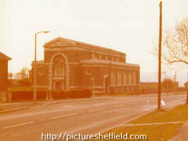
The former St Paul’s Church, East Bank Road, Arbourthorne
When new developments spread across Sheffield between the wars that often meant pubs, but also cinemas and shops. Arbourthorne, like Manor nearby, had a cinema; The Carlton on Eastern Avenue, which opened right at the beginning of the estate story in 1938, closing in 1959 (one of several lost in the city that year alone). The building was used as a factory for a while, but was abandoned and a sorry sight for many years afterwards. The Brightside and Carbrook Co-op arrived in the area in 1958 on Northern Avenue - an event which seems to have been greeted with enthusiasm, even excitement, if the photos are to be believed! Co-op store buildings have over the years told stories of their own; each reflecting the time and place of their opening.
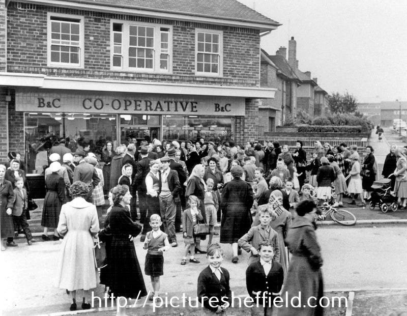
Happy days on the estate - opening of the Arbourthorne Co-op, August 1958
I often muse on questions of identity - how areas of Sheffield can change name or boundaries over time. Like Firth Park, the area we call Norfolk Park is only so because of the park - although the whole area was historically ‘Park’ because of the Deer Park. Arbourthorne though is much older, and it is pleasing that over the centuries, and through much change, it has retained both name and location. The people of today’s Arbourthorne live where in the past coal or stone were extracted, or where farming was the main occupation for much of the land - and if we go back far enough where landed gentry hunted deer in a huge park overlooked by Manor Lodge. This is old history indeed, and compared to Manor maybe not one that is fully appreciated.
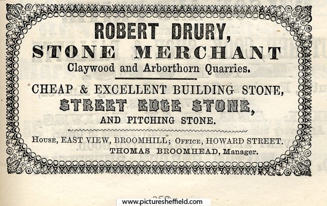
‘Arborthorn’ Quarry ad from the late 1850s